₹14,500 / Person
Seasons: Autumn / Summer
Trek Length: 64 Km
Trip Duration: 8 Days 7 Nights
Trek Difficulty: Difficult
Experience Level: Experienced
Fee Includes: Bageshwar to Bageshwar
Nagkund Kanakata Pass Trek
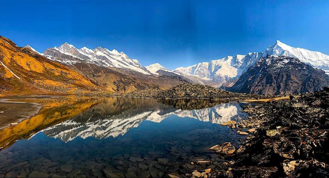
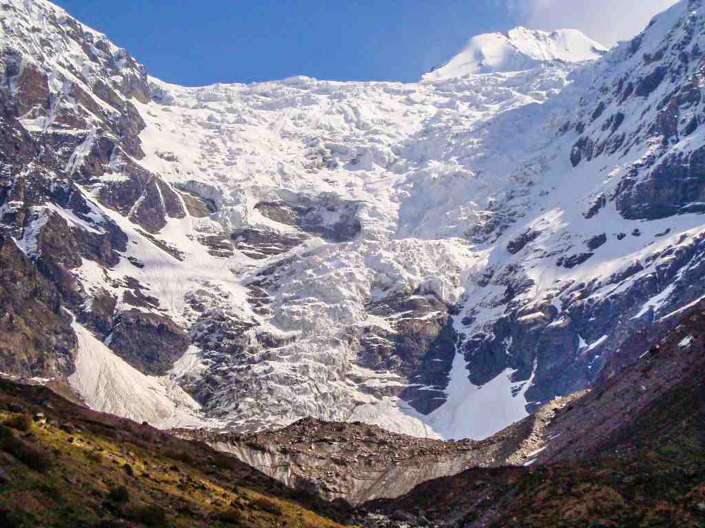
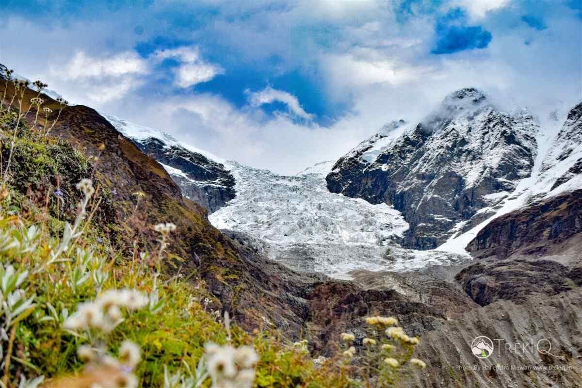
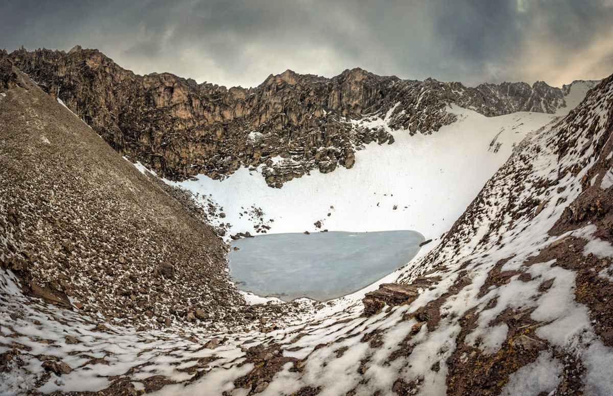
Nagkund Kanakata Pass Trek is a challenging but surprisingly one of the most beautiful treks in the Kumoun Himalayas. It is very satisfying to see the other peaks of the Himalayas from this small beautiful lake situated on the top of the mountain. If you want to feel the Himalayas up close, then this trek will be no less than a paradise for you. Nagkund is a snake-hood-like shaped lake, and the Kanakata is a mountain pass between Sunderdhunga and Pindar Valleys.
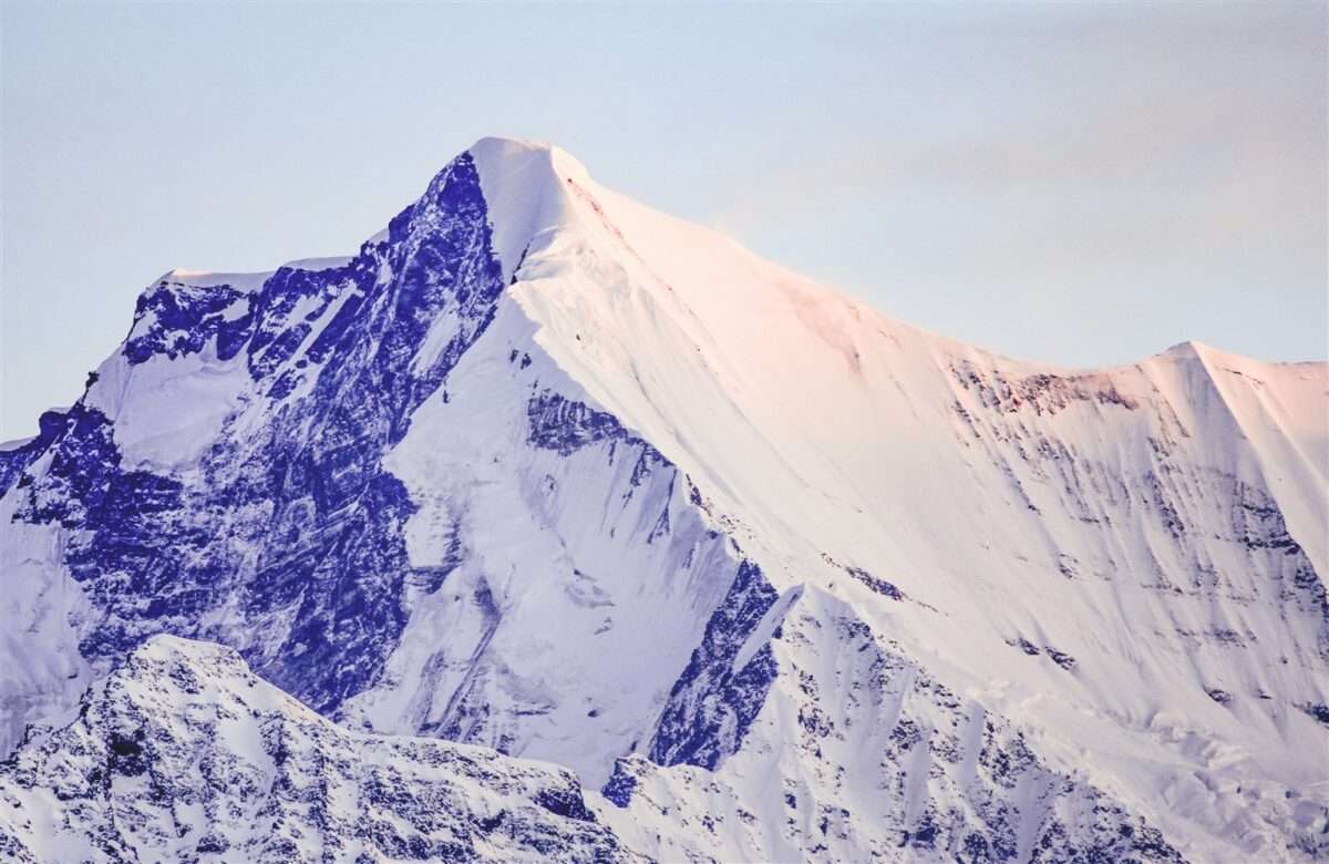
The trail for Nagkund Kanakata Pass Trek starts from the Khati village. Khati is the base camp for the famous Pindari Glacier Trek, Kafni Glacier Trek, and Sunderdhunga Glacier Trek. The expedition of mount Bhanoti(5645m) and Tharkot(6099m) also passes through Nagkund. The altitude of the lake is about 4465m/14649ft. Peaks visible from Nagkund are: Mount Bhanoti (5645m), Tharkot (6099m), Maiktoli (6803m), Devtoli (6788m), Mrigthuni (6855m), Panwali Dwar(6663m).
Attractions of Nagkund Kanakata Pass Trek
- Baluni Top (4000m / 13124ft).
- Devi Kund (4284m / 14055ft).
- Nagkund (4465m / 14649ft).
- Kanakata Pass (4678m / 15348ft).
How to prepare for Nagkund Kanakata Pass Trek
While attempting any Himalayan treks, you should have some preparations, according to the trek difficulties, at least one month prior. You should follow these exercises regularly:
Breathing Exercises
Slowly inhale as long as you can, then hold for a few seconds, then slowly exhale, then again hold your breath for few seconds(3-4 sec). Repeat this whole process up to 8-10 times a day. Try to increase breath holding time and try to breathe only one time per 60 sec or more.
Jogging
You have to do 10 to 20 push-ups in a set of 3 every day for at least one month. It will strengthen your shoulders which helps you to carry your luggage easily. Also, it improves the strength of the lungs.
Staircase ascent/descent
Likewise, you can perform staircase ascent/descent exercise coupled with a weighted backpack. It is the most effective exercise. It will improve knee muscle strength. Therefore, it will help you to ascend uphill as well as to descent downhill.
Why Should you Follow These Exercises?
These exercises will improve your overall performance, which may help to make this trek easier. And most importantly, it will help you get acclimatized to high altitude and reduce the chance of Acute Mountain Sickness or other severe forms of mountain sickness.
Best Time to Visit Nagkund Kanakata Pass
Mid May to June, Mid August to October.
Base camp For Nagkund Kanakata Pass Trek
Khati Village, Bageshwar.
Alternative to Nagkund Kanakata Pass Trek
Short Itinerary
- Kathgodam
- Kharkiya
- Jatoli
- Kathaliya
- Baluni Top
- Devi Kund
- Nagkund
- Kanakata Pass
- Jatoli
- Kharkiya
- Kathgodam
Itinerary
Day 1: Kathgodam to Kharkiya
- Distance - 210 Km
- Driving Time - 9 Hrs.
- Maximum Altitude - 2265m
Our journey will start from Kathgodam. Report at the outside of Kathgodam railway station by 6 am. If you are a group, then we can reschedule pick up as per your arrival. It will take approximately 8-9 hours to reach the Kharkiya. Accommodation will be at the lodge/Homestay at Kharkiya.
Day 2: Kharkiya to Jatoli Via Kanakata Pass
- Distance - 12 Km
- Trekking Time - 7 Hrs.
- Maximum Altitude - 2428m
- Altitude Gain - 163m
Get up early in the morning. We will do some yoga and stretching session to adapt to high altitude and low oxygen environments. The total altitude gain during the trek will be around 2413m / 7917ft. After some heavy breakfast, we will start trekking to Khati village, 6 km away from the Kharkia. Khati is a beautiful, traditional, and cultural village of Uttarakhand. After just 1 km descend, we will cross the river Pinder via a small suspension bridge. When you cross the bridge, you enter into the Sunderdhunga valley, and the trek up to the Jatoli passes through the banks of the Sundardhunga River. Overnight stay will be at Jatoli village, which is 6 km more from Khati.
Day 3: Jatoli To Kathaliya
- Distance - 10 Km
- Trekking Time - 6 Hrs.
- Maximum Altitude - 3290m
- Altitude Gain - 862m
Today’s trek is going to be a bit difficult. The 10 km trail through a dense forest, broken path, boulders, and the river bank will be a challenge for you, so be prepared. Our camp will be at the beautiful campsite, Kathaliya. It is the common point for many nearby attractions like Sukhram Caves, Sunderdhunga Glacier, Maiktoli base camp, Baluni Top, Nagkund, Devikund, and Bhanoti and Tharkot expedition.
Day 4: Kathaliya To Devi Kund
- Distance - 7 Km
- Trekking Time - 7 Hrs.
- Maximum Altitude - 4284m
- Altitude Gain - 520m
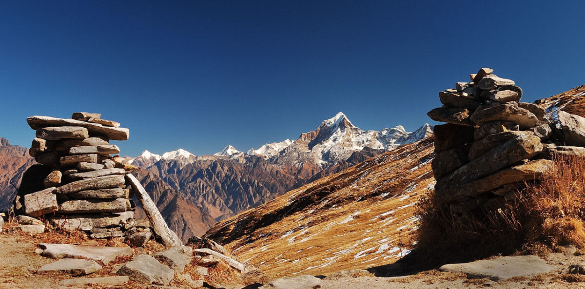
After breakfast in the morning, we will depart towards Baluni Top. After climbing 2 km, we will reach Baluni Top. From here, Maiktoli, Panwali Dwar, Sundardhunga Valley, and dozens of waterfalls falling from the mountains, and the chirping of birds, will mesmerize you. After resting here for a while, we will turn towards the Devi Kund. The trail from Baluni Top to Devi Kund is a bit tough and rocky, and there is a steep climb a little before Devi Kund.
Day 5: Devi Kund to Nagkund
- Distance - 3 Km
- Trekking Time - 2 Hrs.
- Maximum Altitude - 4465m
- Altitude Gain - 181m
There is only a 3 km trek from Devi Kund to Nagkund. We will rest today at Nagkund to get some recovery of body strength. Nagkund is a small but high-altitude lake that lies near the Kanakata Pass. From Nagkund, you will have the best views of Maiktoli and Panwali Dwar Peaks. Enjoy the magnetic views of splendid mountains around you, from a height of more than 4400mm/14500ft.
Day 6: Nagkund to Jatoli
- Distance - 12 Km
- Trekking Time - 7 Hrs.
- Maximum Altitude - 4678m
- Altitude Lose - 2037m
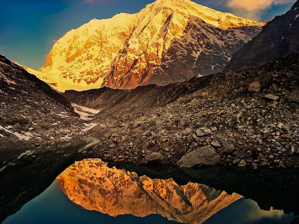
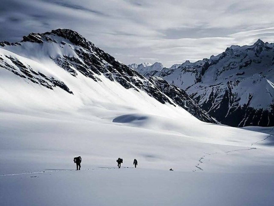
It might be one of the best mornings of your life. You will be witness to the magical sunrise behind the Himalayan peaks. Watching sun rays falling on snow-capped mountains, absolutely amazing, will be something unreal. It is the best view of the Nagkund Kanakata Pass Trek.
Now, it’s time for the Kanakata Pass. First, we will climb to the top of the Kanakata Pass, having an altitude of 4678m or 15348ft, then descend to Jatoli Village. After the pass, the trail is very steep and slippery, so you need a strong will and courage to proceed. Follow the instructions from the guide or trek leader then it will be an easier task for you. We will stay at Jatoli today.
Day 7: Jatoli To Kharkiya
- Distance - 12 Km
- Trekking Time - 8 Hrs.
- Maximum Altitude - 2428m
- Altitude Lose - 393m
Now, it’s time to go back to the Kharkiya via the same route as we followed from Kharkiya to Jatoli. After a 5 km descent, we will cross a suspension bridge on the Sunderdhunga river followed by another bridge on the Pindari river. From here, we have the last 7 km hike to the Kharkiya village via Khati village. We will stay at the lodge at Kharkiya.
Day 8: Kharkiya to Kathgodam
- Distance - 210 Km
- Driving Time - 9 Hrs.
The last day of the trip has arrived. You have completed a challenging trek successfully. Hopefully, you enjoyed this excellent trek and our services. Please give us your valuable feedback about the Nagkund Kanakata Pass trek and suggestions for our future services. Now, with the beautiful memories of the Nagkund Kanakata Pass Trek, you will be departing for the Kathgodam Railway station.
Cost Includes
- Accommodation Hotel/ Guesthouse/ Tents
- Meals as per itinerary
- Safety Equipment (oxygen cylinder, first ad...)
- Tour Guide.
- Trekking Gears like Crampons, Gaiters (If needed).
- Forest entry charges, permits & camping fee.
Cost Excludes
- Porter/Mule charges for carrying personal luggage.
- Any costs arising out of unforeseen circumstances like landslides, roadblocks, bad. Weather, etc.
- Trekking Gears like poncho, poles etc.
- Travel Insurance.
Things to carry
- Waterproof Trekking Shoes
- Woolen/Cotton Socks (Thick) - 3-4 Pairs
- Woolen sweater ( warm & Light )
- Jacket/Windcheater (waterproof 0° to -10° )
- Trek Pants/Lower - 2 units
- Thermal wears - 2 pairs
- Full Cotton T-shirts - 2-3 units
- Inner wears - 2-3 Pairs
- Gloves
- Sun cap
- Woolen cap
- Warm woolen shawl ( Thin & Light )
- Water Proof Rucksack ( 30-60 liter )
- Rain coat/Poncho
- Rain cover for your bag
- Portable Tourch/Headlamp
- Sunglasses
- Water Bottle
- Toiletries
- Winter Moisturizer Cream
- Lip Balm
- Sunscreen Lotion
- First Ad Kit ( ORS, AMS tablets, Band Ad, Pain Relief Spray, Coldarin, etc.)
Map
Frequently Asked Questions
Where is a Kanakata Pass Located?
Kanakata Pass is a high mountain pass with an elevation of 4678m/15346ft, located in the Sunderdhunga Valley. It connects Sunderdhunga Valley with Pindar Valley.
Why is the lake called Nagkund?
The lake is named Nagkund because of its snake-hood-like shape.
Where is the Nagkund located?
Nagkund lies in the lap of mount Bhanoti and Kanakata Pass in the Sunderdhunga Valley, opposite Maiktoli Peak.
In which Biosphere area Nagkund and kanakata pass located?
Nagkund and Kanakata Pass fall in the Nanda Devi Biosphere Reserve Area in Bageshwar District and southwest of the Nanda Devi peak.
Why is Nagkund Kanakata Pass Trek categorized as difficult level 5?
Because of difficult terrain, high altitude gradients, challenging Kanakata Pass, dense forest, boulders, and an average of more than 10 km per day for continue 6 days, it becomes a difficult level 5 trek.
What is the meaning of Sunderdhunga?
Sunderdhunga consists of two words – “Sunder” means beautiful, and “Dhunga” means stone. It means the “valley of beautiful stones”!
What is the elevation of Maiktoli Peak?
The elevation of Maiktoli Peak is 6803m.
Trip Facts
Latitude & Longitude
- 30.178542° N
- 79.877254° E
Max Altitude
4678m / 15348ft
Total trek distance
56 Km
Trip Duration
8 Days 7 Nights
Difficulty Level
- Difficult
- 5
Group Size
1-15
Minimum Age
18
Pickup Point
Kathgodam/Haldwani
Drop Point
Kathgodam/Haldwani
Activities
Essential facts
Nearest Medical Facility
Kapkot
Nearest Hospital
Haldwani
Nearest ATM
Kapkot
Mobile Connectivity
Bharadi, Kapkot
Last Electricity
Khati
Nearest BUS Station
Bharadi,Kapkote
Nearest Railway Station
Kathgodam
Nearest Airport
Pantnagar
Enquire This trek
Send Message
Newly Added
-
 Spiti Valley Exploration Tour
₹20,999Original price was: ₹20,999.₹19,999Current price is: ₹19,999. / Person -
 Kuari Pass Trek
₹9,500 / Person
 -
 Satopanth Lake Trek
₹15,500 / Person
Recently Viewed
Newsletter Signup
You must be logged in to post a review.
Nearby Treks…
Kafni Glacier Trek
- ₹11,500 / Person
- Book Now
Sunderdhunga Glacier Trek
- ₹15,500 / Person
- Book Now
- Rated 5.00 out of 5
Pindari Glacier Trek
- ₹10,500 / Person
- Book Now
Similar Treks..
Roopkund Lake Trek
- ₹14,500 / Person
- Book Now
- Rated 5.00 out of 5
Bali Pass Trek
- ₹18,500 / Person
- Book Now
Chopta Tungnath Trek
- ₹5,000 / Person
- Book Now



Nagkund Kanakata Pass Trek Reviews
There are no reviews yet.