₹16,500
Autumn / Summer
Total Trekking Distance: 55 Km
Trip Duration: 8 Days
Trek Difficulty: Challenging
Experience Level: Experienced
Pickup & Drop: Joshimath
Kagbhusandi Lake Trek
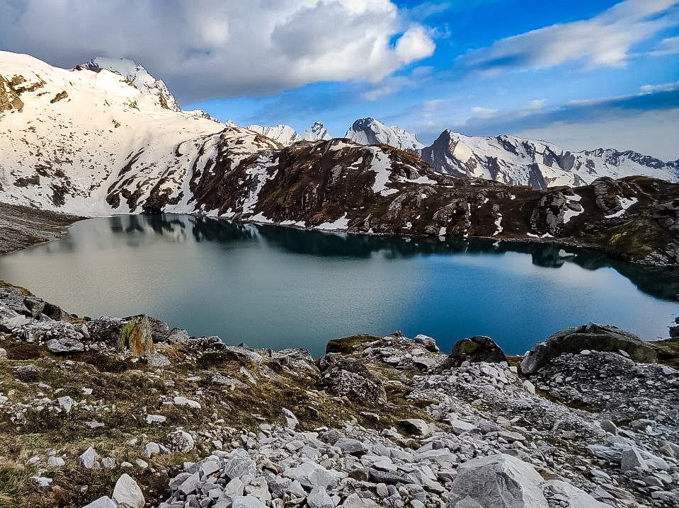
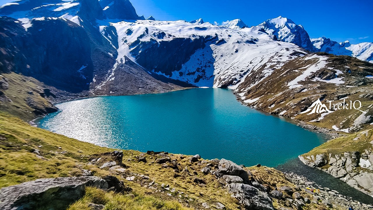
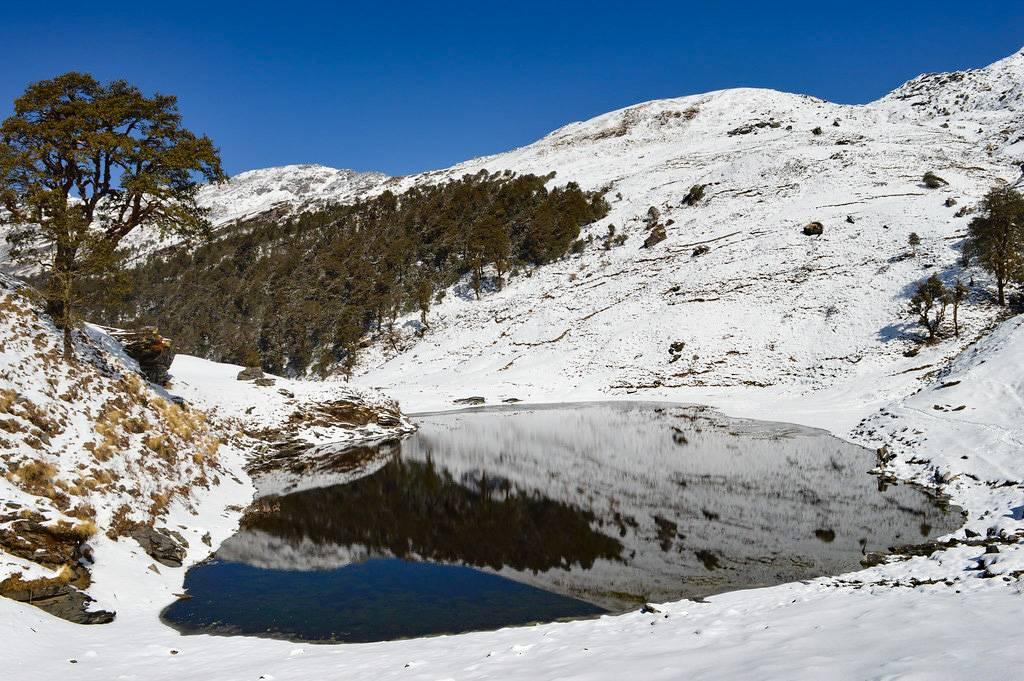
Kagbhusandi Lake Trek is a hidden gem in the Garhwal Himalayas. Kagbhusandi Lake is a beautiful freshwater lake with an elevation of about 4330 meters / 14206 feet and is an ultimate paradise for nature lovers, photographers, meditators, adventure seekers, and Himalayan wanderers. In addition, the Kagbhusandi lake trek is full of flora and rich biodiversity. Many rare flowers of the Himalayas are scattered in the valleys here. The water of Kagbhusandi Lake is very pure and healthy and has a sweet taste. The Kagbhusandi Lake has an ancient spiritual belief of Hinduism. Therefore, do not disrespect the sacred Kagbhusandi Lake and the faith.
Brahma Kamal (Saussurea Obvallata):
The high elevations of Kagbhusandi lake and surrounding areas are suitable for the sacred Brahma Kamal, which means you will see thousands of flowers flourished near the Kagbhusandi Lake. This rare Himalayan flower is considered sacred in the Hindu tradition. It is also known to have immense medicinal value and symbolizing healing. Flowers bloom in mid-monsoon (July–August) amongst the rocks and grasses of the hillside at an altitudinal range of 3000–4800m. You can see these flowers till mid-oct. In the Himalayas, the Brahma Kamal is usually blooming above 4000 m. Flower heads are purple, hidden from view in layers of yellowish-green papery bracts, which protect them from the cold mountain environment. The Brahma-Kamal blooms only at midnight.
Phen Kamal ( Saussurea Simpsoniana ):
Above 4400m altitude, you will find a rare Himalayan Flower Phen Kamal ( Saussurea Simpsoniana ). Phen Kamal grows in the Himalayas from Kashmir to Sikkim, at 3800-5600m altitude. In Kagbhusandi Lake Trek, you will see Phen Kamal after Kankul Pass ( 4664m ) up to 4400m, above the Kagbhusandi lake (4325m). This trek is one of the few treks where you can see Phen Kamal and Brahma Kamal together in abundance. These flowers glow in the moonlight.
Machhi Tal, a glacial lake in the lap of Hathi Peak:
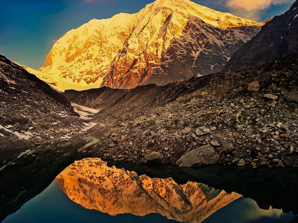
Machhi Tal ( Fish Lake ) is a glacial lake about 2 km away from Rajkharak Campsite-2. Some of you people, who will be fit, will get a chance to see the Machi Tal. The elevation of the Machhi Tal is about 4238m / 14002ft.
Mountain Passes during Kagbhusandi Lake Trek:
- Kankul Pass(4664m / 15300ft).
- Barmai Khal(4515m / 14813ft).
- Farswan Vinayak Pass(4100m / 13451ft).
Things you must keep in mind near kagbhusandi Lake:
- Use a clean pot or bottle to take water from the lake.
- If you need to clean your body parts, clothes, or utensils, wash them away from the lake, and make sure the water would not enter the lake.
- Do not spit on the lake.
- Please leave your toilet on the other side of the lake and cover it well with soil.
How difficult is the Kagbhusandi Lake Trek?
Due to broken trails, lots of boulders (more than 60% part of the trek), three high-altitude mountain passes, and extreme cold, we classified Kagbhusandi Lake Trek as a challenging trek. Therefore, this trek is not for beginners. Even if you are an experienced trekker, you also need some preparation before going. You have to be physically and mentally fit before attempting Kagbhusandi Lake Trek.
How to prepare for the Kagbhusandi Lake trek?
Do some preparations before attempting any Himalayan treks according to the trek difficulties, at least one month prior. You should follow these exercises regularly for the Kagbhusandi Lake Trek, at least 1 month prior to the trek:
Breathing Exercises:
Slowly inhale as long as you can, then hold for a few seconds, then slowly exhale, then again hold your breath for few seconds(3-4 sec). Repeat this whole process up to 8-10 times a day. Try to increase breath holding time and try to breathe only one time per 60 sec or more.
Push-ups:
You have to do 10 to 20 push-ups in a set of 3 every day for at least one month. It will strengthen your shoulders which helps you to carry your luggage easily. Also, it improves the strength of the lungs.
Jogging:
Jog for 30-60 min regularly. You can put some weight on your backpack while jogging. It will increase your stamina and also strengthen your lungs and muscles.
Staircase ascent/descent:
Likewise, you can perform staircase ascent/descent exercise coupled with a weighted backpack. It is the most effective exercise. It will improve knee muscle strength. Therefore, it will help you to ascend uphill as well as to descent downhill.
Why should I follow these exercises?
These exercises will improve your overall performance, which may help to make this trek easier. And most importantly, it will help you get acclimatized to high altitudes and reduce the chance of Acute Mountain Sickness or other severe forms of mountain sickness.
Best time to visit Kagbhusandi Lake
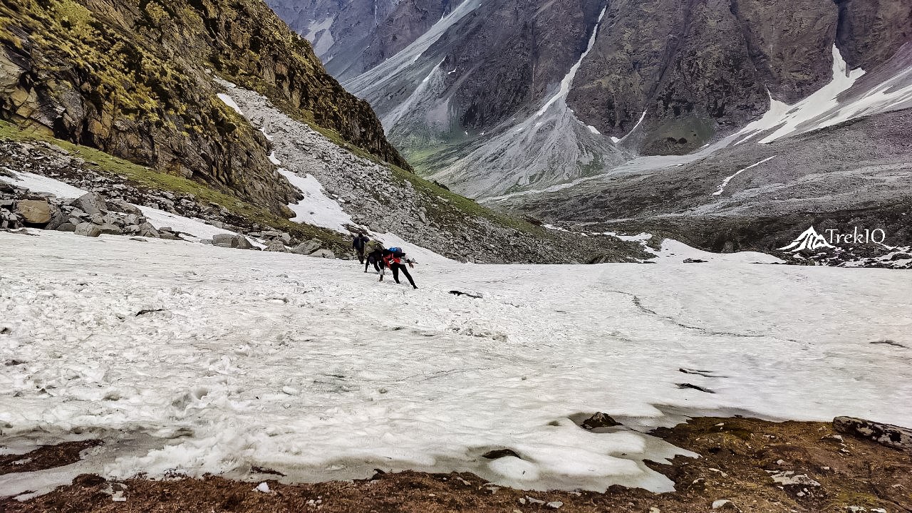
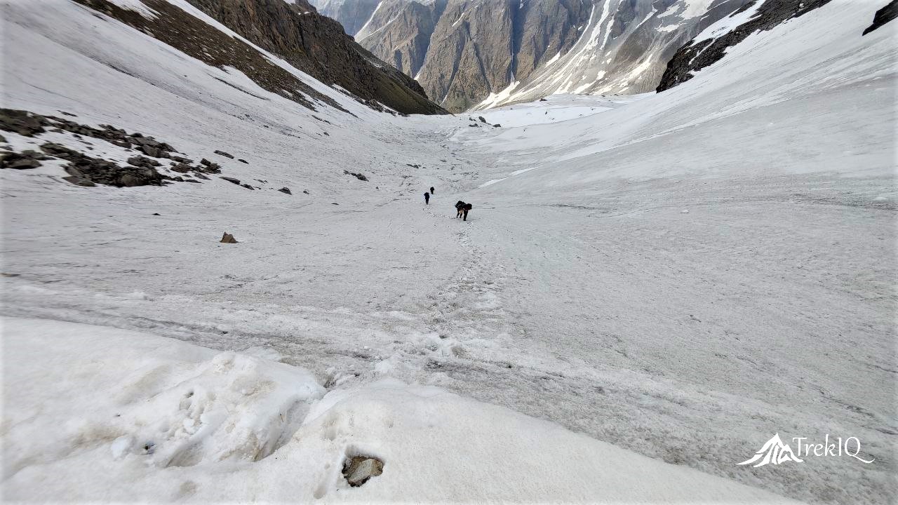
The best time to visit Kagbhusandi Lake Trek is September and October. You can attempt during May-June also, but there will be a heavy snow layer from Dang Kharak to Barmai pass and Farswan Vinayak. So Kagbhusandi trek will be hard and risky to do in this period. Avoid the rainy season(July-August) due to enormous water in streams, landslides, and high-risk factors.
Base camp for Kagbhusandi Lake Trek
Govindghat, Distt. Chamoli, Uttarakhand, PIN code-246443.
Alternative to Kagbhusandi Lake Trek
Short Itinerary
- Rishikesh
- Govindghat
- Bhyudar
- Simartoli Bugyal
- Raj Kharg
- Kankul Pass
- Kagbhusandi Lake
- Barmai Kharak
- Painka Gaon
- Kathgodam/Rishikesh
Kagbhusandi Trek Itinerary
Day 1: Rishikesh/Kathgaodam to Govindghat - Pick-up from Joshimath
- Distance - 280 Km
- Driving Time - 10 Hrs.
- Maximum Altitude - 1904m
On the first day of the trip, you have to reach the base camp Govindghat from Rishikesh or Kathgodam. If you are coming via Rishikesh, then you can use public transport from Rishikesh. You can find plenty of options available for transportation from Rishikesh to Govindghat. You will get a bus/taxi from morning 4.00 am. You can choose from Private/Govt Buses or Taxis. You have to leave Rishikesh in the morning as early as possible. The distance from Rishikesh to Govindghat is around 280 km, which could take more than 10 hours due to bad roads in few places.
Similarly, if you are coming via the Kathgodam side, you can hire a taxi from Kathgodam. It is the only fastest option available. There is no direct transportation for Govindghat available from Kathgodam/Haldwani.
If you choose public transportation, then you will need to divide your journey. The traveling distance from Kathgodam to Govindghat is 311 km via Gairsain.
The Traveling plan you can follow is:
Kathgodam/Haldwani > Dwarahat > Chaukhutiya > Gairsain > Karnprayag > Joshimath > Govindghat.
We will pick you from Joshimath, and your stay will be at Govindghat/Pulna.
Day 2: Govindghat to Simartoli via Bhyundar
- Distance - 4.5 km Drive + 13 Km Trekking
- Driving Time - 30 min.
- Trekking Time - 8 Hrs.
- Maximum Altitude - 3350m
- Altitude Gain - 1576m
Our trek starts from Pony stand, Pulna. We will drive to Pulna village, which is 4.5 km away from Govindghat. Our first target will be the Bhyundar village(3350m /10990ft), 6 km from Pulna. It should take about 2-3 hours for 6 km trekking. After crossing the Bhyudar village, you will see the confluence of the Laxman Ganga river and the Simartoli Nala. The left-side trail goes towards the Ghangharia or the Hemkund or the Valley Of Flowers. The right-side trail goes to the Kagbhusandi Lake Trek and passes through the forest, riverside, and meadows. Simartoli bugyal is 7 km away from the Bhyundar.
The location of Simartoli Bugyal is pleasant and very relaxing. It’s an open area offering a splendid view of mountains and flora.
Day 3: Simartoli bugyal to Raj Kharg
- Distance - 7 km
- Trekking Time - 4 Hrs.
- Maximum Altitude - 3972m
- Altitude Gain - 622m
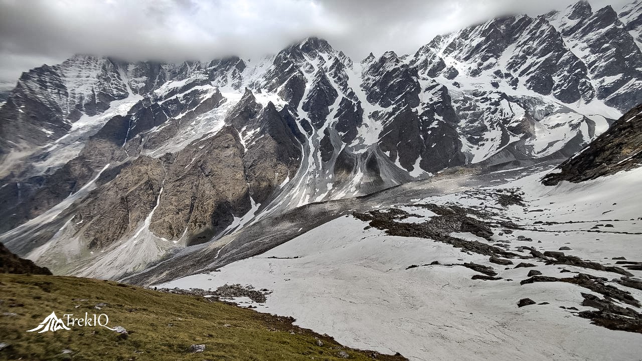
Today, you will be going to face lots of boulders and scrambling challenges. After trekking around 1 km, we will get into the river and proceed along with the river. Then after hiking another 1.5 km, you will need to climb a cliff with the help of the scrambling technic. Then you will be at Dang Kharg. The Raj Kharg campsite is only 4km away from this point. This valley lies underneath the Hathi Parvat( 6727m).
Day 4: Raj Kharg to Kagbhusandi Lake Via Kankul Pass
- Distance - 7 km
- Trekking Time - 6 Hrs.
- Maximum Altitude - 4664m
- Altitude Gain - 672m
Ready to face the real challenge in 5 km of steep climbing. With the backpack, it will be going to be very tough. After a 5 km climb, you will reach the U-shaped Kankul Pass (4664m), the highest point on the Kagbhusandi Lake Trek. As we cross 4000 m altitude, you will witness the beauty of thousands of Brahmkamal. Also, some other Himalayan flowers and herbs flourished in the valley. Finally, we reached Kagbhusandi Lake, which is 2 km away from the Kankul Pass. We will get rest, and overnight stay will be in tents.
Day 5: Explore Nearby Places and Kagbhusandi Lake area
Rest Day for you now. Also, you will have a chance to regain your strength and to get acclimatization. Explore the Kagbhusandi Lake areas and capture the moments for lifetime memories. Do some meditation here, and feel the spirituality around you. From Kagbhusandi Lake campsite, you can identify Urgum Vally, where 5th Kedar ‘Kalpeshwar’ is located. Also, 4rth Kedar ‘Rudranath’ can be sighted. Apart from these, a hidden ‘Chinap Valley’ is visible from the campsite. Which is a lesser know valley but full of a variety of flower species.
Day 6: Kagbhusandi Lake To Barmai Kharg Via Barmai Khal
- Distance - 7 km
- Trekking Time - 6 Hrs.
- Maximum Altitude - 4515m
- Altitude Lose - 300m
Today, we will cross the second mountain pass of the trek. For that, we will first ascend 1 km, where we will found a small Kund, and we will see Brahma Kamal on the whole path. Then, after descending 2 km, we reach the river. From here, you will have to climb 2 km to reach Barmai Khal (Mountain pass at 4515m). While proceeding towards Barmai Kharg(1.5 km away from the Pass), you should be careful while descending through the cliff. Our campsite will be beside the small river at Barmai Kharg.
Day 7: Barmai Kharg to Vishnuprayag Via Farswan Vinayak Pass
- Distance - 17 km
- Trekking Time - 10 Hrs.
- Maximum Altitude - 4100m
- Altitude Lose - 2495m
After getting breakfast early as possible, we will start our trekking towards the third and the last mountain pass named Farswan Vinayak (4100), 3km away from Barmai Kharg. While reaching Farswan Vinayak, you will get a clear view of Neelkantha and Chakhamba Peaks, with the Swargarohini and Panpatia snowfields. The Painka village is about 10 km from here, and the Badrinath highway is 3 km more from Painka Village.
Day 8: Vishnuprayag to Rishikesh
- Distance - 270 Km
- Driving Time - 10 Hrs.
Bravo! You completed one of the best challenging treks in the Garhwal Himalayas. You have earned life-changing experiences and unforgettable memories from the Kagbhusandi Lake Trek. Now you are set to go towards your destinations.
Kagbhusandi Trek Price
₹16,500 – Joshimath to Joshimath
Inclusion
- Transportation
- Accommodation Hotel/ Guesthouse/ Tents
- Nutritious meals as per itinerary.
- Safety Equipment (oxygen cylinder, first ad...)
- Tour Guide and support staff.
- Trekking Gears like Crampons, Gaiters (When needed).
- Forest entry charges, camping fee, and other charges.
- Necessary Permit
Exclusion
- Porter/Mule charges for carrying personal luggage.
- Any costs arising out of unforeseen circumstances like landslides, roadblocks, bad. Weather, etc.
- Trekking Gears like poles, shoes, poncho etc.
- Travel Insurance.
Things to carry
- Waterproof Trekking Shoes
- Woolen/Cotton Socks (Thick) - 3-4 Pairs
- Woolen sweater ( warm & Light )
- Jacket/Windcheater (waterproof 0° to -10° )
- Trek Pants/Lower - 2 units
- Thermal wears - 2 pairs
- Full Cotton T-shirts - 2-3 units
- Inner wears - 2-3 Pairs
- Gloves
- Sun cap
- Woolen cap
- Warm woolen shawl ( Thin & Light )
- Water Proof Rucksack ( 30-60 liter )
- Rain coat/Poncho
- Rain cover for your bag
- Portable Torch/Headlamp
- Sunglasses
- Water Bottle
- Toiletries
- Winter Moisturizer Cream
- Lip Balm
- Sunscreen Lotion
- First Ad Kit ( ORS, AMS tablets, Band Ad, Pain Relief Spray, Coldarin, etc.)
Kagbhusandi Lake Trek FAQs
Kakbhushundi or Shri Kak Bhusundi (Sanskrit: काकभुशुण्डि) is a sage found in Hindu Scriptures in Hinduism. He is one of the characters of Ramcharitmanas, one of the most important Hindu texts, written by Saint Tulsidas. The word ‘Kak’ literally means ‘crow’ and is associated with the name because the sage was transformed into a crow by the sage Lomas in his final incarnation. He decided to spend his life in the form of a crow near Kagbhusandi Lake.
For more information, click here.
The total trek length of the Kagbhusandi Lake Trek is approximately 54 km from Govindghat to the Vishnuprayag.
Absolutely no, you must not do Kagbhusandi Lake Trek without a guide, or as a solo trekker, because from Bhyundar to Painka village, there is a 47 km trek where you will not find any shelter or village. Also, glaciers have destroyed most of the trail, so very difficult to keep track in the right direction. Many trekkers tried to go alone on the Kagbhusandi lake trek without a guide, but they lost their way, and they had to return from the midway.
You are eligible for Kagbhusandi Lake Trek if-
- You have prior experience in high-altitude treks ( above 3500m ).
- You have previously done any long Trek ( 25+km trek length).
- You have completed a basic/advanced mountaineering course.
- You are an athlete and do running regularly.
- You have good stamina.
- You are having no issues related to breathing/lungs/heart.
Acclimatization is the process in which an individual organism adjusts to a change in its environment, allowing it to maintain performance across a range of environmental conditions. Acclimatization occurs in a short period and within the organism’s lifetime.
We can observe acclimatization when traveling to high altitude locations, such as tall mountains. For instance, if an individual hikes to 3,000 meters above sea level and stays there for 1-3 days, they become acclimatized to 3,000 meters. If the same person hikes to 4000 meters in altitude, their body has to acclimatize once again. Some of the changes that take place during acclimatization to high altitudes involve:
- Increment of red blood cells.
- Increased pressure in pulmonary arteries. Thereby forcing blood into sections of the lungs that are usually not used during normal breathing at lower altitudes.
- Increased depth of respiration.
In some cases, individuals suffer from Acute Mountain Sickness when ascending to elevations of over 3,000 meters from sea level. However, it is a common and mild condition. If the body gets enough time, then it can be overcome. It happens due to reduced air pressure at high altitudes as well as lower oxygen levels. One of the more severe forms of mountain sickness is called High Altitude Cerebral Edema, where fluid builds up in the brain. It is a life-threatening situation and requires immediate medical attention.
Kagbhusandi Lake Trek
Kagbhusandi Trek facts
Latitude & Longitude
30.629216° N 79.665368° E
Max Altitude
4664 m / 15300ft
Total trek distance
55 Km (Govindghat to Vishnuprayag)
Trip Duration
8 Days 7 Nights
Rishikesh to Rishikesh
Difficulty Level
Challenging Level 2
Group Size
4-15
Age Group
18-50
Essential facts
Nearest Medical Facility
Joshimath
Nearest Hospital
Joshimath
Nearest ATM
Joshimath
Mobile Connectivity
Govindghat/Painka Gaon
Last Electricity
Bhyundar/Painka Gaon
Nearest Bus Station
Joshimath
Nearest Railway Station
Rishikesh
Nearest Airport
Dehradun
Kagbhusandi Lake Trek Reviews
1 review for Kagbhusandi Lake Trek
You must be logged in to post a review.
Similar Treks..
Brahmatal Trek
- ₹8,500
- Book Now
- Rated 5.00 out of 5
- -5%
Spiti Valley Exploration Tour
-
₹20,999Original price was: ₹20,999.₹19,999Current price is: ₹19,999. - Book Now This product has multiple variants. The options may be chosen on the product page








Dheeraj Jyeshta (verified owner) –
Amazing Thrilling Experience!!!!
“Not recommended for beginners” Toughest trek to date but heavenly beautiful and peaceful at the end. I completed this trek in Oct 2020 with 3 more trekkers. Most of the trail was broken and full of lots of boulders. It is impossible to find the right path without an experienced guide. But every trekker or mountaineer should have this challenging trek on their bucket list.